

| Version 9 (modified by , 17 years ago) ( diff ) |
|---|
Languages:
| short description | author | description | version | |
|---|---|---|---|---|
The default JOSM display mode uses XML based style files to render for the map with colouring, line thickness, icons after tags. You can also customize your map as you like. New style URLs can be entered when editing this page.
Rendering
Mappaint renders the map data so it looks much more like a map (colors, icons, annotations, ...) - compared to the JOSM wireframe mode.
Nodes
Most nodes that corresponds to tags in the Map Features page will show an appropriate icon, e.g. a "P" on blue ground for amenity=parking.
There are some special icons for missing/incomplete things:
 missing icon
We don't have the right icon for every node tag in map features yet, e.g. icons for most natural=xy tags are still missing. If you encounter such a "missing icon", feel free to create a nice 16*16 pixel icon that matches the tag and send it to the talk list.
 warning icon
The corresponding tag was once used but is no longer recommended to be used - or - it is not suitable for a node, e.g. highway=motorway just doesn't make sense on a node. Probably not all deprecated tags will show this icon.
Ways
Most ways that correspond to tags in the map features page will get special color, thickness and line style (e.g. dashed lines for railways).
Areas
Areas are ways that form a sort of ring. Most areas that corresponds to tags in the map features page will be filled with a special color (the filling will be transparent to some degree).
Direction arrows
Direction arrows in this mode are only drawn for selected items, this gives you a a significant speedup while moving the map.
Create your own style
You don't like the standard style? Change it to your own liking:
- Either use one of the above styles or the standard one as base for own styles
- Now you can edit the file (a small help is at the top comment of the standard file)
- When you made new icons, add a path to these in mappaint.icon.sources
- ... restart JOSM and your new style will be used!!
Style Collection
If you have an interesting style that might be useful for others, please just add it here. Please fill out the description fields (so the list above is more informative).
- The OSM2Go source archives contain as of version 0.6-4 a potlatch like JOSM style and of version 0.6-5 an additional Mapnik like JOSM style on the data directory. These were written for OSM2Go and have not been tested with JOSM.
Preferences
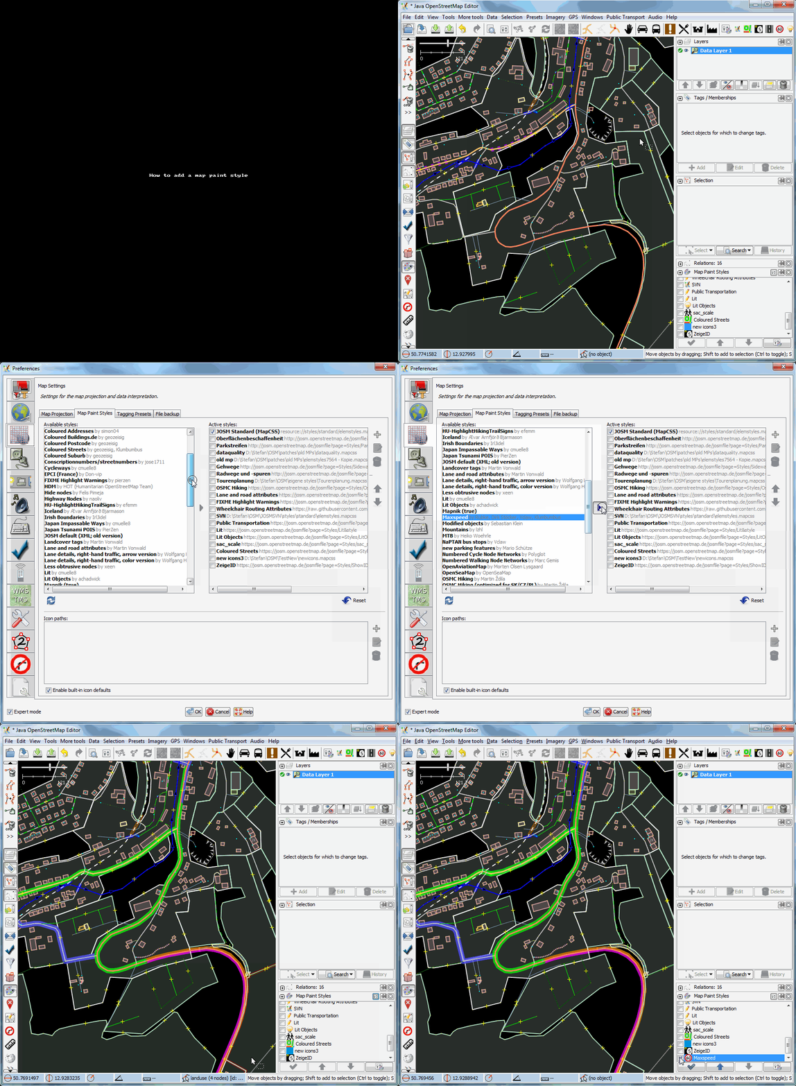
In the preferences editor you handle new style files as well as paths to the icons. Note that styles can be either additional or individual. If a style itself has a new internal name, then switching the "standard" default to this name creates a new display. Styles with equal names are additional. If you want to change the name of a style, you need to add the new name in front of the path using a "=" as separation. The same can be used for icon paths.
You also can use the following hidden preferences:
- mappaint.fillalpha
- alpha "opacity level", that is used to fill areas. An integer value between 0 (transparent) and 255 (solid) with the default of 50.
- mappaint.fillareas
- true (default) - areas will be filled with their corresponding colour
- false - areas will be surrounded by dashed lines
- mappaint.useRealWidth
- true (default) - ways will change width corresponding to the real width in meters set in the elemstyle.xml file
- false - ways will have the same width on every zoom level (no longer the default since mappaint 6030)
Attachments (3)
-
Mappaint_deprecated.png
(650 bytes
) - added by 17 years ago.
deprecated icon
-
Mappaint_no_icon.png
(335 bytes
) - added by 17 years ago.
no icon
-
addstyle.gif
(1.8 MB
) - added by 12 years ago.
How to add a map paint style
Download all attachments as: .zip